With 20 years of specialized expertise, BushProof maintains the most comprehensive hydrogeological data resource for the south of Madagascar publicly available. We continuously collect, process and share knowledge to empower sustainable groundwater extraction and water access projects across the island.
The objectives of our work are :
Improving knowledge of the hydrogeology of Madagascar
Producing tools of interest for the development of groundwater use in Madagascar
To disseminate and improve access to relevant data for the water sector
Improving the quality of work in the sector
This webpage is dedicated to the publication of data and products concerning Madagascar’s hydrogeology and groundwater resources.
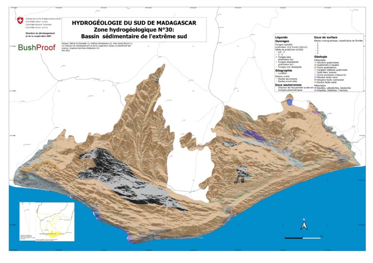
The latest publication was funded and created with the support of two hydrogeologists from the Swiss Agency for Development and Cooperation (SDC). It is a cartographic tool designed to improve knowledge of how groundwater functions in southern Madagascar, as well as some thematic maps. This tool was produced in 2023.